What makes one Port Royal waterfront lot feel effortless while another comes with hidden complexity? If you are buying or evaluating property here, the answer is often not just the home itself, but the water in front of it. Understanding whether a lot faces Naples Bay, a canal, or the Gulf edge can help you read view quality, boating function, and future permitting with much more confidence. Let’s dive in.
Why water type matters in Port Royal
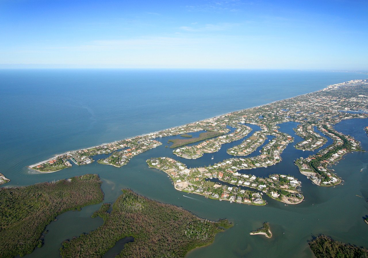
In Port Royal, “waterfront” is not one category. Naples sits within a broader system that includes the Gulf of America, Naples Bay, Gordon Pass, and a network of canals, so two lots with similar square footage can live very differently depending on their frontage.
That distinction matters because lot value is often shaped by your relationship to the water. The breadth of the view, how usable the frontage is for boating, and how much regulatory review may come with docks, dredging, or coastal construction can all affect how a property feels and functions over time.
How to read a bayfront lot
Bayfront parcels usually offer the most open feel. Because they face Naples Bay or Gordon Pass rather than a contained canal, they often deliver broader horizons and a stronger connection to the larger waterfront setting.
That openness can be a major draw if you want a lot that feels visually expansive. At the same time, Naples Bay is an active and environmentally sensitive waterbody, and the City of Naples monitors its water quality monthly. The city also notes that Naples Bay has lost about 90% of its seagrass beds since 1950, which makes depth awareness, channel discipline, and responsible boating especially important.
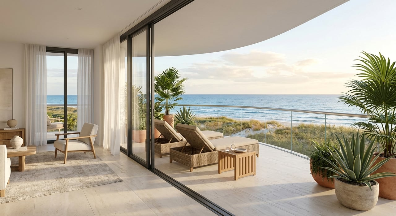
What bayfront can mean for daily use
A bayfront setting often appeals to buyers who prioritize view width and a more direct boating identity. You may feel more connected to the larger waterway network, but you should also expect more open-water conditions than you would on a sheltered canal.
It is also smart to look closely at neighboring docks and the way the shoreline is configured. On open water, those elements can shape both your sightlines and the practical use of the frontage.
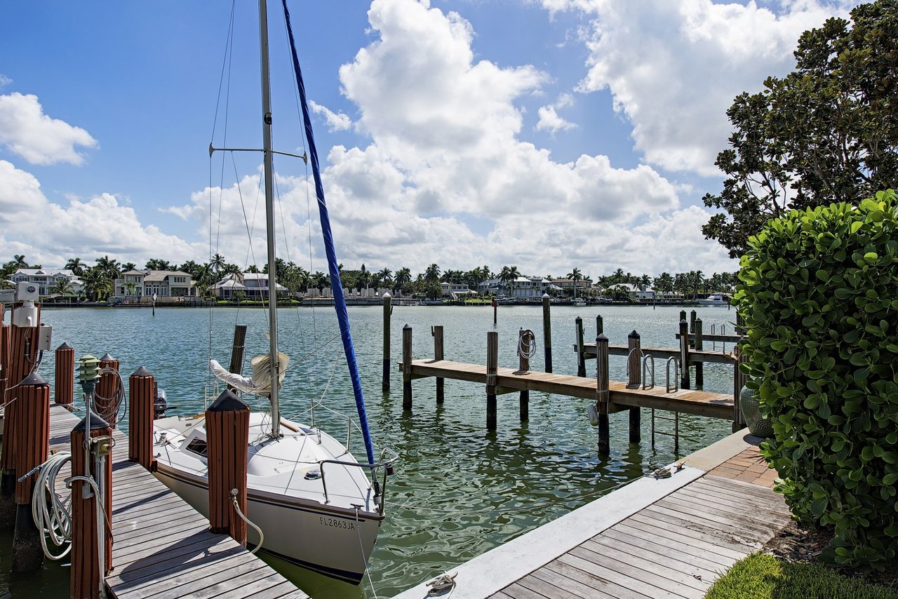
How to read a canal-front lot
Canal-front lots usually feel more protected and private. For many buyers, that calmer setting is part of the appeal, especially if you want a more tucked-away experience while still having waterfront access.
Still, canal lots depend heavily on the canal itself. Width, turning room, and maintenance can all change how easy the property is to use, even when two homes appear similar on paper.
Canal width and turning matter
A canal is not just a backdrop. If you plan to keep a boat at the property, the width of the canal and the dock placement can affect how comfortably you can approach, turn, and depart.
That is why a canal-front comparison should go beyond frontage numbers alone. A dock that sits cleanly on the lot and allows practical maneuvering can make a meaningful difference in day-to-day ownership.
Canal maintenance can affect ownership
The City of Naples treats manmade canals differently from natural water bodies when reviewing dredging applications. That matters because future maintenance may follow a different path depending on the specific waterbody in front of the lot.
Port Royal also has a completed canal dredging special assessment area, which shows that canal maintenance can become a neighborhood-level ownership issue. Even when the work is complete, buyers should confirm whether any balance remains on the property tax roll.
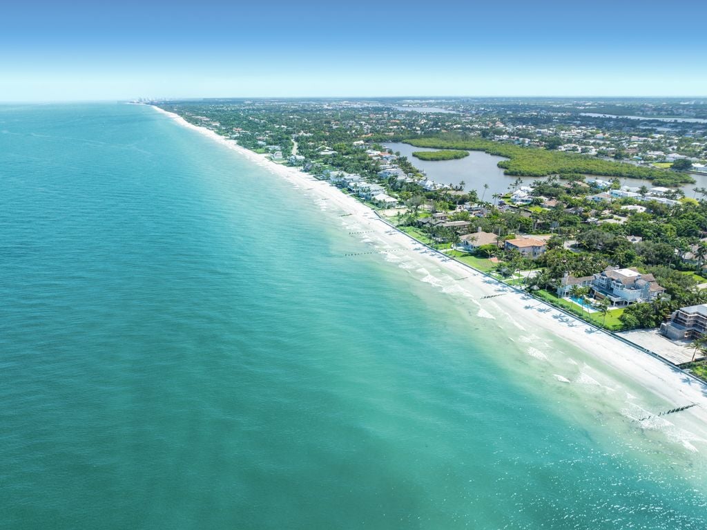
How to read a Gulf-side lot
Gulf-facing or beach-edge parcels often carry the strongest coastal presence, but they also come with the most coastal constraints. These lots can offer a dramatic setting, yet they require especially careful review before you plan construction, site work, or shoreline improvements.
In Naples, a Coastal Construction Setback Permit is required for new construction, excavation, fill placement, and shoreline-protection work seaward of the Coastal Construction Control Line, also called the CCCL. For a buyer, that means the beauty of a Gulf-side parcel should always be considered alongside the permitting path.
Flood zone review is essential
The City of Naples states that the 2024 flood maps are in effect, and exact flood-zone status should be confirmed before purchase or construction. This is especially important on Gulf-side property, where coastal exposure may be more significant.
If a parcel is in Zone VE, it is in a coastal high-hazard area where wave action can cause structural damage. That does not tell you whether to buy or not buy, but it does tell you that flood and construction review should happen early.
Docks are part of the lot story
In Port Royal, a dock is not just an amenity. City code says piers, boat lifts, pilings, seawalls, and riprap can require marine permits, so the usefulness of the waterfront depends in part on what is actually allowed on that parcel.
This is one reason experienced waterfront buyers look beyond photos and listing language. The real question is whether the dock layout supports the way you intend to use the property.
View corridors and navigation count
City rules say piers may not interfere with safe navigation. The code also says rafting may not interfere with neighboring piers or the view of the waterway from neighboring properties.
That means a dock should be evaluated as both a boating feature and a design constraint. A setup that preserves navigation and respects view corridors may support better long-term usability than one that simply maximizes hardware on the water.
Some mooring rules are lot-specific
Some properties fronting Naples Bay, Gordon Pass, and additional Port Royal locations shown on a Port Royal Association map have special allowances for offshore mooring piles. In practical terms, dock utility can vary parcel by parcel, even within the same neighborhood.
That is why two nearby waterfront homes can offer very different boating setups. If water access is central to your plans, you want to verify the exact configuration that is permitted at that address.
The questions to ask on every Port Royal tour
If you are serious about Port Royal, it helps to approach each showing with the same waterfront checklist. Clear answers early can save time and help you compare lots more accurately.
Start with the frontage type
Ask what is actually in front of the lot: Naples Bay, a canal, or the Gulf edge. That single answer changes the likely view breadth, boating utility, and permitting path.
Confirm flood-zone status
Ask whether the parcel is in a coastal flood zone and whether it is in Zone VE. The city says current flood information should be confirmed before purchase or construction, and that review can shape both building decisions and ownership planning.
Check for CCCL implications
If the property is Gulf-side or near the beach edge, ask whether any part of a future project would be seaward of the CCCL. If so, additional coastal permitting and vegetation rules may apply.
Review the dock history
Ask what dock, lift, and mooring-pile configuration is allowed and whether it respects neighboring view corridors. Existing improvements do not always answer the full question, especially if you may want to reconfigure the site later.
Ask about dredging and assessments
If the lot is canal-front, ask whether any dredging history, maintenance issue, or special-assessment balance is attached to the property. The Port Royal dredging assessment area is complete, but assessments remain on the rolls while they are being paid.
Who should help you evaluate a lot
For a high-intent Port Royal purchase, the most useful team usually includes an experienced waterfront agent, a surveyor, and a flood, coastal, or marine professional. Together, they can help verify the frontage type, flood exposure, dock envelope, and likely permit path.
That process is often what separates a beautiful waterfront impression from a waterfront lot that truly works for your goals. In a neighborhood like Port Royal, that clarity matters.
If you are weighing two lots or trying to understand the trade-offs between a canal, bayfront, or Gulf-side position, local context is everything. The right guidance can help you read not just the view, but the long-term usability and value behind it.
If you are considering a purchase or sale in Port Royal, The Beachfront Team offers discreet, high-touch guidance shaped by deep local waterfront expertise.
FAQs
What does waterfront mean for a Port Royal lot?
- In Port Royal, waterfront can mean frontage on Naples Bay, a canal, or the Gulf edge, and each one can affect view width, boating use, and permitting differently.
What should you ask about a Port Royal canal-front property?
- You should ask about canal width, turning room, dock layout, dredging history, and whether any special-assessment balance remains on the property tax roll.
Why is flood-zone status important for Port Royal buyers?
- The City of Naples says current flood maps are in effect, and exact flood-zone status should be confirmed before purchase or construction, especially for coastal lots that may be in Zone VE.
What is the CCCL for a Port Royal Gulf-side lot?
- The Coastal Construction Control Line is the coastal boundary that can trigger additional permitting for new construction, excavation, fill placement, and shoreline-protection work seaward of it.
Why do docks need extra review in Port Royal?
- Docks, lifts, pilings, seawalls, and related marine features can require permits, and their placement must also avoid interfering with safe navigation and neighboring waterway views.